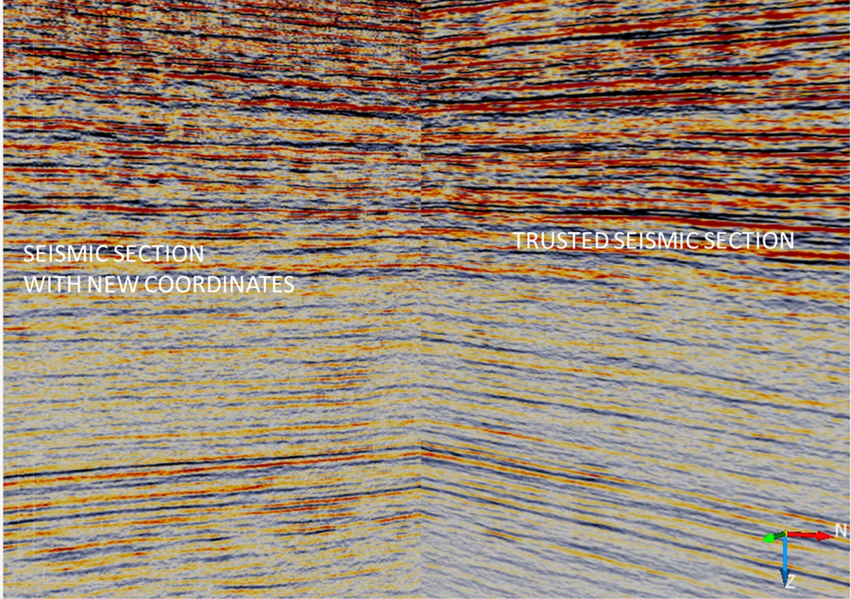
We have a seismic line with several SEG-Y files, in some cases with the same length, in others with a different length and a different process or the same process carried out in different years by different companies. When the coordinates of the SEG-Y files are plotted, they do not overlap and can be at distances of between 30 m, 70 m or even more.
To solve this problem, all the SEG-Y files are loaded into an interpretation platform and cross them with another seismic lines which coordinates are reliable. Once we have the best match between the seismic events, the coordinates of this SEG-Y file are taken and assigned to the other versions of the same line.